A Day in the Life: Mapping Water Points in Sierra Leone
The Water Project strives to bring water to those who need it most, and the first step is to figure out where the need is. But the process of collecting that information isn’t as straightforward as you might think.
In a wealthier country, if you wanted to conduct a survey asking who has access to water in a particular area, you could ask local waterworks departments for their coverage areas. If the responses uncovered any gaps, you could contact residents via phone, email, or mail. It might take time, but there would be plenty of resources to aid your search.
Those resources are not always available in sub-Saharan Africa.
When we asked the team members of our local partner, Mariatu’s Hope, to gather data over the three chiefdoms we serve in Sierra Leone, it wasn’t exactly a simple request. But despite all the odds against the mapping team, they faced the challenges head-on and completed the work ahead of schedule.
“I am glad I am part of this work,” said mapping enumerator Zainab. “That is why I commit myself daily in doing it to the best of my ability.”
“In the office, we meet together in the morning hours to pray and arrange the sites we are going to do for the day,” Zainab continued. “The bike (motorcycle) riders that are assigned to some of us will also be part of the meeting, so that they, too, will be aware of our movement for the day. They would use that opportunity to check the bikes [to see] if they are ready to go. After putting things in place, we leave the office for the targeted community.”
“Some communities will warmly welcome us,” said field officer Foday. “Even the smiles from the community members make us feel at home. Obviously, the children would be fond of us. This alone gives us more motivation to do the work to the very best of our ability.”
“[The] gathering of information will always be difficult if [the stakeholders] are unavailable,” said field officer Alimamy. “So, it takes time and patience to gather information. There are schools and health facilities that we visited twice before gathering the correct information.”
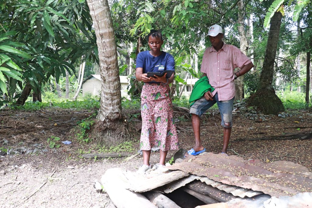
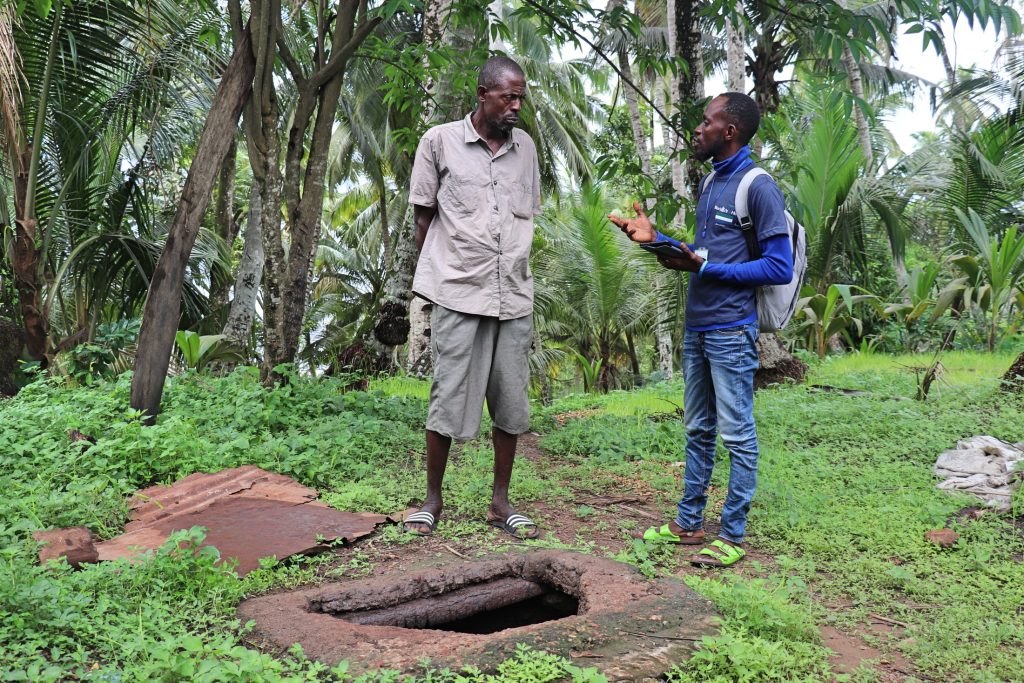
One of the most important parts of mapping is explaining the reason for the survey to each respondent and getting their permission to record the information (a practice the enumerators refer to in their quotes as “informed consent”).
It’s also essential for participants to know that, although our field officers represent a water organization, their presence in a place doesn’t necessarily mean that they would receive a new water point. As we’ve said before, our goal is to make it so everyone in our service areas has access to water within a reasonable walking distance. We will, no doubt, be returning to some of the communities we visited during mapping to install water points, but not all of them. Our main goal is to identify the communities that still need water, but we also have to map those communities that have sufficient water access in order to know that they are covered. In those covered communities, the enumerators are sure to explain this clearly whenever they began an interview.
“Initially, some of the community members thought we were representing the government or any political party,” Foday explained. “But…I assured them, and I gave them a comprehensive explanation [about] the reasons for the mapping, stating clearly that we are not in any form of politics.”
“During the informed consent process, we always remind communities that we never make promises,” said field officer Julius. “This makes us unique, as several NGOs have lied to most communities. But for us, we are different. As a result, we avoid [making] promises for us not to raise their hopes.”
“For every water point, health facility, and school we [visited], we talked to people that are knowledgeable,” Julius continued. “We asked the questions one at a time so that the respondents would give us answers, but we never [dictated] answers to them. We allowed them to tell the stories, as they know more about the situation than us.”
“We, the enumerators, are mindful of the questions we asked, knowing clearly that this mapping is not based on promises or any political affiliation,” said enumerator Nyuma.
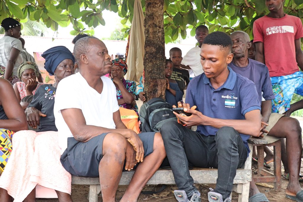
“That is why, before we start our work in the community, we make sure we seek the consent of the stakeholders such as [the] chief, headman, youth leader, if any,” Nyuma continued.
“Then, based on these responses, we have the green light to proceed. We make sure to explain to them the purpose of our visit, [the] reason for the current mapping work, and informed consent. I was fortunate to interview the deputy head teacher at St. Peter’s RC Primary School. It was not easy. It was my first time sitting in front of the camera to do an interview.”

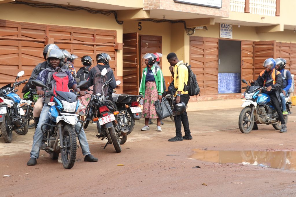
One reason our service areas don’t have water before our intervention is a lack of infrastructure. Bad roads prevent big drill rigs from making their way to communities that need wells. A storm can wash out a road, and no one will come to fix it for a long time. Sometimes, our teams have to drive hours (or even days!) out of their way in order to reach a specific spot.
“It’s a little bit challenging riding a bike on a difficult outreach area,” said field officer Alie. “Sometimes, I [would] get stuck on the road due to the sand, although I did not sustain [an] injury.”
“In some of those communities, we trekked almost seven miles to reach [them],” said mapping enumerator Alimamy. “Some of the mappers got tired and [were] unable to walk with their boots. They decided to remove them and walked with bare [feet].”
The mapping enumerators in Sierra Leone recently completed mapping for all three of the chiefdoms where we work: Lokomasama, Kamasondo, and Kaffu Bullom. Some sections were easier than others to reach.
“The mapping exercise [was] always positive for us, [even] with all the challenges we faced in the field,” said field officer Foday. “It all [depended] on the distance to the community, road, network, and the weather. All these challenges the team [encountered] during the mapping, but despite the challenges, we [were] able to triumph over them. There [were] times when we [would] find it easier, especially when we were in Lungi compared to Kamasondo or Lokomasama. Everything was good and easy in Lungi because the road and network did not affect us. So, a day for the team [could] be full of challenges or less constraints. This is the beauty of the work we do, as it evaluates our patience and perseverance.”
“The hot, burning sun [was] another negative effect that was disturbing the team in the survey,” said field officer Alimamy.
“During the dry season, there is a lot of dehydration/sweating that prevents [us] from doing the amount of survey needed for a day,” Alimamy continued.
“The hot, burning sun makes us become tired and return to the office as [quickly] as possible. Sometimes, the sweating will make us remove our clothes [to] allow them to get dried. It can also lead to headaches and weakness of the body. The raining season was another challenge, as we always know that we cannot use our pads (tablets) and phones under the rain. A heavy downpour of rain will prevent the team from working on a particular day.”
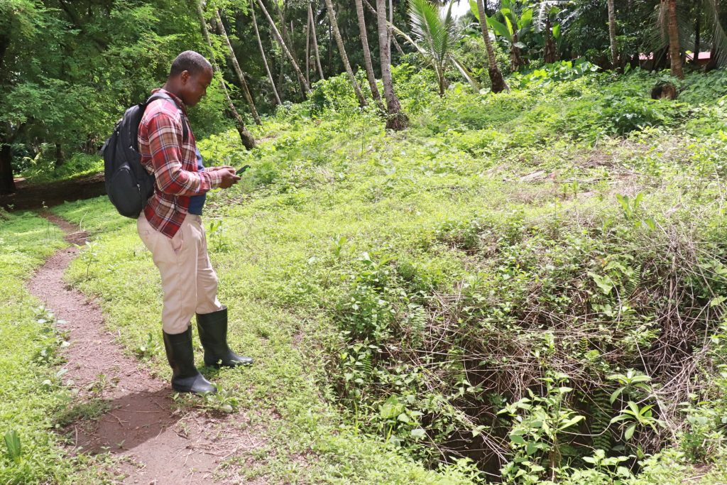
But the weather and roads weren’t the only obstacles. As you can imagine, cellular connectivity is not nearly as ubiquitous in sub-Saharan Africa as it is in the U.S. So, while someone surveying an area in the U.S. might upload their survey data in real-time, our team members in Kenya, Uganda, and Sierra Leone have to make adjustments, uploading their data to our water point management data platform, mWater, only when and where they can get a signal.
“The poor mobile network has also affected us as a team,” said Alimamy. “We normally find it difficult to find a central location if there is a poor network. This problem prevents us from submitting our [surveys] on time.”
But thankfully, as the field team has said, none of the challenges could prevent them from completing this essential work. With the mapping data, we are now better equipped to help the people in Sierra Leone suffering every day because they don’t have access to a reliable, safe water source.
“So far, the mapping exercise has been a success to us, the mappers, and the organization,” said Alhaji.
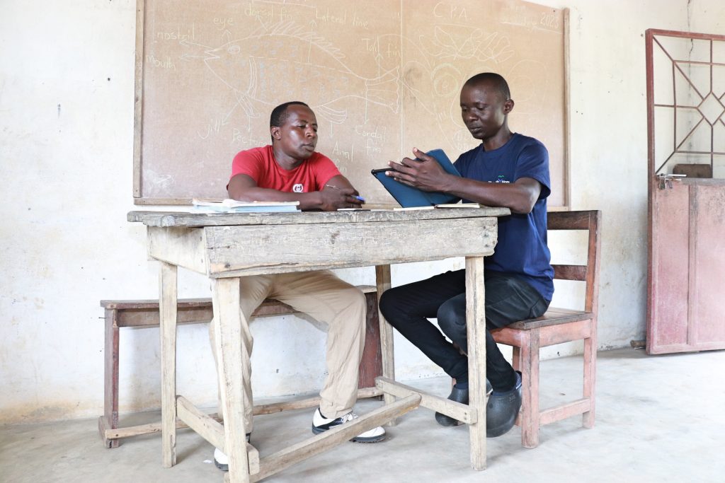
“I’m hopeful that the information from the mapping will help to tackle the present water situation in [the] most deprived communities that are within our three chiefdoms of operation,” said Julius. “Honestly, I count myself privileged to be among the enumerators for this mapping exercise. This is a new experience for me since I have never engaged in such mapping before. But nevertheless, I have learned a lot in collecting accurate information in the field by using mWater. Despite the challenges, we are more than overcomers since challenges are part of life, and they help us to gain experience.”
We are now looking over our preliminary results from mapping in Sierra Leone. Stay tuned for the actual results, available later this summer! In the meantime, we invite you to choose a community in Sierra Leone, or our other service areas, to support. As our mapping exercise has revealed, there are plenty of people still waiting for the gift of clean water.
Home More Like ThisTweet
Jamie Heminway
Jamie is a storyteller by nature. In joining the Water Project, she’s finally found a workplace where that pesky bleeding heart of hers can be put to use (and, less importantly, that BA in English Language & Literature from New England College).